Table of Content:
- Cadastral Map Meaning
- Indian States & UTs With Cadastral Maps Online
- Cadastral Map Details
- Importance of Cadastral Map
- Cadastral Map Online Benefits
- Cadastral Maps in Maharashtra
- Cadastral Maps in Gujarat
- Cadastral Maps in Delhi
- Cadastral Maps in Uttar Pradesh
- Cadastral Maps in Rajasthan
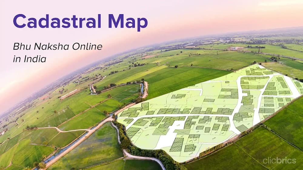
A cadastral map is a detailed map of a specific land area, showing individual land parcels' boundaries, ownership, and other related information. In India, cadastral maps are used for various purposes, including land management, urban planning, resource allocation, and survey. Creating cadastral maps involves surveying the land and recording its boundaries, features, and ownership information. This data is then processed and integrated into a digital map, which can be accessed and updated.
The Digital India Land Record Modernization Programme (DILRMP) was launched in 2008 by the Central Government to digitise and modernise land records as well as develop a centralised land record management system. These cadastral maps in India(also known as Bhu Naksha) are typically used by government agencies, land developers, real estate professionals, and individuals to identify property boundaries, settle disputes, and development plans.
If you want to know how to find your state’s cadastral map online and its importance, this blog is your single-stop solution!
Cadastral Map Meaning
A cadastral map(bhu naksha) is a large-scale map showing boundaries and sub-divisions of land. It is used for research and making a record of property ownership.
NIC (National Informatics Centre) developed cadastral mapping software to use these land maps to view the ownership status of the lands in various regions of India. A Digital India Land Records Modernisation Programme was launched in 2008 to maintain digital, spatial, and textual forms of land records.
Notably, the Prime Minister of India Sh. Narendra Modi also launched a property/cadastral map survey program in 2020 called Survey of Villages Abadi & Mapping with Improvised Technology in Village Areas (SVAMITVA). The State and Central Governments carry out property surveys, digitise updated land records and update the ownership status of properties in various regions and states as per this survey program.
Indian States & UTs With Cadastral Maps Online
The following states and UTs in India have updated cadastral maps online:
Andhra Pradesh
Bihar
Chhattisgarh
Dadra & Nagar Haveli
Delhi
Goa
Gujarat
Haryana
Himachal Pradesh
Jammu & Kashmir
Jharkhand
Karnataka
Kerala
Lakshadweep
Madhya Pradesh
Maharashtra
Odisha
Punjab
Rajasthan
Telangana
Uttar Pradesh
Uttarakhand
West Bengal
Cadastral Map Details
The details that you can find in a land’s cadastral view are:
Boundaries and ownerships of land parcels
Certificate of title numbers
Section or lot numbers
Names of adjoining or adjacent streets
Boundary dimensions selected
Names of the surveying district
Positions of existing structures
Unique identifying numbers for every parcel
Importance of Cadastral Map
Here’s why a Jamabandi Cadastral map is important:
Cadastral map provides accurate, precise, and legitimate information related to land records of a specific state.
Cadastral map online helps you check the size, the boundaries and the demarcation of the land you want to buy.
Land records online saves the effort of visiting government offices to get the same.
Provides you with detailed information related to the ownership and area of the property.
Cadastral map helps you evaluate the value of property along with the taxes applicable.
Assists during the transfer and administration of ownership of a property.
They help you know about the legality of a given plot and whether you can build on it or if it's government land demarcated for public reasons.
Here’s everything you can handle using cadastral maps and plans:
Urban planning
Establishing titles
Financing and development
Use of national property grants
Land policies and information distribution
Cadastral Map Online Benefits
The benefits of using online cadastral maps are:
Cadastral maps online have all the updated information and real-time updates.
They provide accurate data to all website visitors and reduce the possibility of unauthorised or fraudulent deals.
They help in resolving legal property-related disputes and reduce the chances of any misunderstanding.
How to View Jamabandi Cadastral Map Online For Your State?
Here is a list of states with the process of downloading their cadastral maps online:
Cadastral Maps in Maharashtra
Step 1: Visit the BhuNaksha portal of Maharashtra: https://mahabhunakasha.mahabhumi.gov.in/bhunaksha/27/index.jsp to obtain cadastral maps of your chosen location.
Step 2: Provide the required details like:
Category
District
Taluka
Village
Map type
Sheet number
Step 3: Once you enter all these details, you will get a cadastral map for your chosen location. You can also get the cadastral ap details of your preferred property using the plot number.
Also Read: BhuNaksha Chhattisgarh 2023: Check Land Records Online Easily
Cadastral Maps in Gujarat
The steps to get the cadastral view are:
Step 1: Visit the online revenue portal of Gujarat
Step 2: Scroll down and click on Village Maps
Step 3: Select the district and download the map of the location you want
Check Out: Gujarat Land Records Online
Cadastral Maps in Delhi
The steps to get the cadastral map view in Delhi online:
Step 1: Visit the web portal of Delhi Land Records
Step 2: Scroll down and click on Village Maps
Step 3: Provide the required details like:
Division
District
Village
Rectangle
Khasra
Step 4: Download the Bhu Naksha of your land
Also Read: Steps To Check Online Land Records In Delhi
Cadastral Maps in Uttar Pradesh
The steps to get the cadastral map in UP are:
Step 1: Visit the BhuNaksha portal of UP
Step 2: Provide the required details like:
District
Tehsil
Village
Step 3: You can get cadastral maps in Uttar Pradesh once you enter all these details
Cadastral Maps in Rajasthan
The steps to get the cadastral map are:
Step 1: Visit the BhuNaksha portal of Rajasthan
Step 2: Provide the required details like:
District
Tehsil
RI
Halkas
Village
Sheet number
Step 3: You can get cadastral maps in Rajasthan once you enter all these details
Check Out: Land Records Online/Cadastral Map in Rajasthan
Now that you know the meaning of cadastral maps, its importance & benefits, you can read our blogs to know the steps to check cadastral map online/bhu naksha of your state.
Find cadastral views for Bihar, Punjab, Odisha, Jharkhand, Telangana and many more right here!